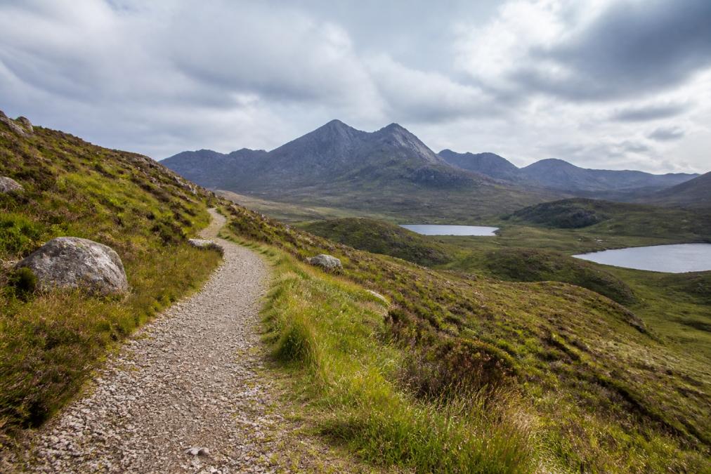
 how-to
How to Find Quiet Walking Trails Near the Cuillin Mountains
Table of Contents
- Why the Cuillin Rewards Walkers Who Plan for Solitude
- Mapping the Cuillin: Black Cuillins, Red Cuillins and the Foothills
- Step 1: Choose Your Season and Time of Day to Avoid the Crowds
- Step 2: Study the Best Quiet Hikes on the Isle of Skye
- Step 3: Read the Micro-Climate Before You Set Off
- Step 4: Pack Essential Hiking Gear for the Scottish Highlands
- Step 5: Safety Tips for Hiking the Cuillin and Knowing When to Turn Back
- Step 6: Reach the Trailhead by Public Transport or on Foot
- Leave No Trace on Fragile Cuillin Ground
- Frequently Asked Questions
Last Updated: September 11, 2026
Why the Cuillin Rewards Walkers Who Plan for Solitude
The Cuillin mountains on the Isle of Skye draw climbers and walkers from around the world, yet the busiest footpaths see the vast majority of traffic concentrated on a handful of honey-pot routes. According to NatureScot's guidance on landscape and recreation, the pressure on Skye's most popular trails has grown sharply in recent years, and the difference between a crowded outing and a solitary one comes down almost entirely to planning.
This guide sets out how to find quiet walking trails near the Cuillin, from choosing the right season and hour to reading micro-climates, plus the gear, safety checks and transport that make a quiet day possible.
The reward: instead of queuing for a viewpoint, you get the ridge, the glen and the silence to yourself. Solitude near the Cuillin isn't about walking further, it's about walking differently.
Mapping the Cuillin: Black Cuillins, Red Cuillins and the Foothills
The Cuillin divide into two ranges. The Black Cuillins are the jagged, dark gabbro peaks around Glen Brittle and Sligachan, offering technical terrain, scrambling and serious exposure. The Red Cuillins to the east are rounded, granite hills with grassy lower slopes, far gentler and considerably quieter.
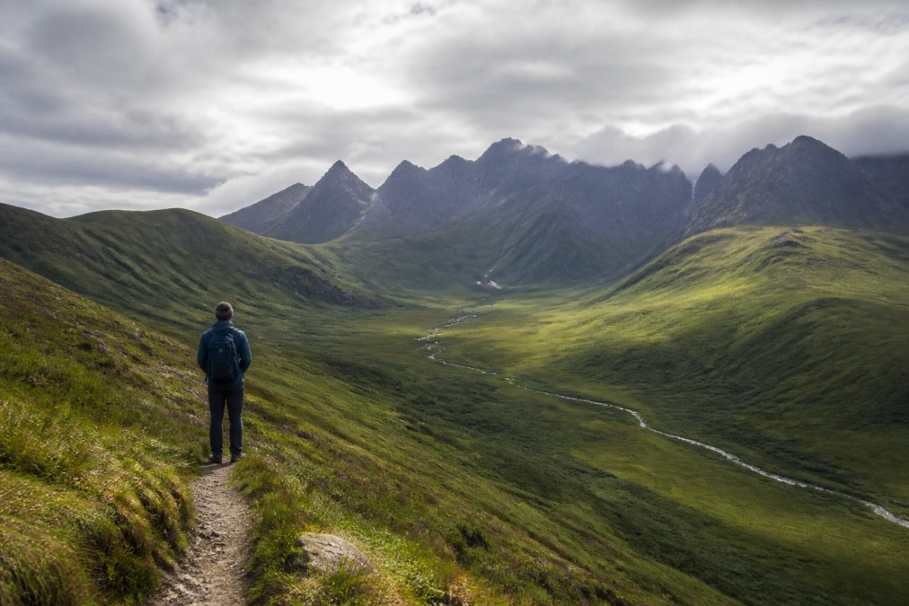
Between and beneath both ranges lie the foothills: footpaths, old stalkers' tracks and moorland edges that rarely appear on the busiest itineraries. This is where quiet walking trails are easiest to find, manageable terrain, simpler navigation, and views of the high Cuillin arguably better than from the summits.
Step 1: Choose Your Season and Time of Day to Avoid the Crowds
Timing alone removes most of the crowd. In summer, day-trippers and tour groups cluster between mid-morning and late afternoon. Walk early, late, or outside peak season, and the same paths feel entirely different.
A practical rhythm that works well:
- Start before 8am in summer to reach a trailhead ahead of the first tour coaches
- Walk after 4pm in spring and autumn, when the light is best and the paths empty
- Favour April, May, September and October for fewer visitors and stable conditions
- Avoid bank holiday weekends and the middle of July and August if solitude is the goal
The shoulder seasons also bring longer shadows, clearer air and a better chance of seeing the ridge without a line of walkers strung across it. Staying locally puts you on the path before the first ferry-load of visitors arrives.
Step 2: Study the Best Quiet Hikes on the Isle of Skye
Most guides list the same famous routes and call them the best. The quietest walking near the Cuillin comes from a repeatable selection method, not a list, the routes that stay empty are the ones that fail the criteria crowds use to choose.
The Four-Filter Method for Finding Quiet Routes
Apply these filters in order and you will consistently land on trails that see a fraction of the traffic:
- Start point away from a car park. Honey-pot routes begin where a vehicle can stop. A trailhead with a marked car park, bus stop and viewpoint sign will be busy; routes starting from a passing place, a bridge, or a walk-in from a settlement stay quiet.
- No single obvious objective. A route with one named summit or famous viewpoint attracts everyone to the same line. Linking two or three low tops, or looping a glen without a headline destination, disperses any walkers who do find it.
- Circular, not out-and-back. Out-and-back routes force everyone onto the same path in both directions. A circuit through the Red Cuillins or a glen-edge loop means you may pass one or two parties at most, and often none.
- Lower than the cloud line. Routes that stay below roughly 400 metres avoid the scramblers, the guided groups and the ridge traffic entirely, while still delivering the Cuillin views.
Named Quiet Options Worth Knowing
The Red Cuillin circuit around Glamaig's lower skirts is the classic example: grassy, rounded, and bypassed by almost everyone heading for the Black Cuillin. The foothill paths above Sligachan, old stalkers' tracks threading the moorland between road and glen, are walkable in a half day and rarely see more than a handful of people. The lower slopes and lochan paths on the eastern side, approached from minor roads, offer genuine solitude with the ridge as a backdrop.
Ridge Walks and Foothill Footpaths Away from the Honey Pots
Ridge walks and foothill footpaths offer the finest viewpoints of the high Cuillin without the technical demands of the black ridge. A stalkers' track along a glen edge, a moorland path skirting a lochan, or a low ridge above a quiet bay all deliver big views and genuine solitude, the drama of the Cuillin without the exposure or the crowds.
| Route Type | Terrain | Typical Crowds | Best For |
|---|---|---|---|
| Red Cuillin circular | Grassy, rocky | Low | Full-day solitude |
| Foothill footpath | Moorland, track | Very low | Easy half-day walks |
| Low ridge walk | Rocky, exposed | Low | Scenic viewpoints |
| Black Cuillin ridge | Technical, exposed | High | Experienced scramblers |
The Solitude Test Before You Commit
Before you settle on any route, run one final check: can you describe where the crowds will be, and how your route avoids them? If not, the route is probably not quiet. The best quiet walks near the Cuillin are chosen by subtraction, removing the routes everyone else is heading for.
Step 3: Read the Micro-Climate Before You Set Off
Micro-climates decide what a Cuillin walk actually feels like. Weather can differ sharply between a sheltered glen, an exposed ridge and the coast, sometimes within an hour, so an island-wide forecast tells you little about your specific footpath. The skill is using the forecast to choose which side of the range to walk.
Reading the Three Signals
Before you leave, check three things:
- Wind direction and strength on exposed ground. Wind is the biggest determinant of comfort and safety. A strong westerly makes the western glens and coastal edges hostile while the eastern, leeward slopes stay calm.
- Cloud base on the Cuillin. If the cloud is sitting low on the peaks, the ridge is out. The foothills may be entirely clear.
- Visibility trend from the sea. Coastal fog can swallow a ridge in minutes while a glen a few kilometres inland stays clear. Watch whether the fog is building or clearing.
Finding Shelter on a High-Wind Day
When the wind is too strong for exposed ground, don't cancel, change which side of the range you walk. The prevailing wind is south-westerly, so the eastern slopes and north-east-running glens are typically sheltered. A route in a glen bottom, on a leeward hillside, or threading trees or a wall will feel like a different day from the ridge above.
Practical shelter-finding rules:
- Walk the leeward side. If the wind is from the west, walk the eastern slopes. If it is from the north, walk the southern.
- Stay low and stay in the glen. Glen bottoms and the lower foothills are sheltered by the terrain itself.
- Use the terrain, not just the map. A low ridge between you and the wind does more than any clothing.
- Turn around at the top of the shelter. If your route climbs out of the sheltered glen onto exposed ground, that is your natural turnaround point on a windy day.
Finding Quiet Ground on a Low-Visibility Day
Low cloud is not just a safety problem, it is an opportunity. When the ridge is in cloud, crowds stay away and the foothills and glens below the cloud line become genuinely quiet. Choose a route that stays entirely below the cloud base, with clear handrails such as a wall, stream or track, so reduced visibility does not become a navigation problem.
The Micro-Climate Advantage
Most walkers check the island forecast, see wind or cloud, and cancel or head for the same low-level fallback. Read the micro-climate and pick the sheltered side of the range instead, and you get a comfortable day and a quiet one at once. The weather that empties the popular routes hands you the sheltered ones.
Step 4: Pack Essential Hiking Gear for the Scottish Highlands
Essential hiking gear for the Scottish Highlands is built around one reality: conditions change fast, and staying dry and warm is a safety matter, not a comfort one. Even a short foothill walk can turn cold and wet within an hour, so pack for the worst the day might offer, not the weather at the trailhead.
The core kit for a quiet Cuillin walk:
- Waterproof jacket and trousers that pack small and breathe
- Sturdy waterproof footwear with good ankle support for rocky terrain
- Gaiters to keep heather, bog and scree out of your boots
- Layers including a warm mid-layer and a spare insulating layer
- OS map and compass, plus a charged phone as backup only
- Emergency shelter and a head torch, even on a short day
- Food and water for the full route, with a little extra
Pack light but pack completely: the walker carrying an emergency shelter and spare layer can afford to change plans when the weather shifts.
Step 5: Safety Tips for Hiking the Cuillin and Knowing When to Turn Back
Safety tips for hiking the Cuillin circle back to one principle: the decision to turn back is the most important one you'll make. The Cuillin are genuine mountains, and the Black Cuillin ridge involves scrambling, exposure and technical terrain that should only be attempted by experienced parties with the right skills.
Before you set off, leave your route and expected return time with someone, check the mountain weather forecast, and set a clear turnaround time based on daylight and conditions rather than ambition. If visibility drops, if the wind strengthens on exposed ground, or if the cloud base falls onto the ridge, turn back. The mountain will still be there.
Step 6: Reach the Trailhead by Public Transport or on Foot
Reaching the trailhead without a car is easier than many visitors assume, and it's one of the most effective ways to find quiet walking trails. Buses serve the main settlements, and several foothill and Red Cuillin routes start within walking distance of a stop or a short local transfer. Walking in from your accommodation removes the parking scramble and adds a quiet stretch to your day.
Public transport also shapes your route choices in a useful way. Linear routes between two stops become practical, and you avoid the pressure of returning to a single trailhead. Combine a bus out with a walk back, or plan a circular route that begins and ends on foot. Traveline Scotland's journey planner lets you check connections before you commit to a route.
The Mountaineering Scotland guidance on hillwalking safety is worth reading before any Cuillin outing, particularly on navigation and turnaround decisions in poor visibility.
Leave No Trace on Fragile Cuillin Ground
Quiet routes are quiet because few people use them, and that fragility is easy to damage. Moorland, bog and high glen ground recover slowly from erosion, litter and campfire scars. Stick to established footpaths, carry out everything you bring in, and avoid wild camping on fragile vegetation, choose durable ground and leave the spot as you found it.
The same principle applies to wildlife and the working landscape. Keep dogs under control, close gates, and give grazing animals a wide berth. Solitude and stewardship go together: the trails stay quiet and unspoiled only if the people who find them treat them carefully.
The challenge with quiet walking trails near the Cuillin is that the best ones take local knowledge to find, and the weather can rewrite your plan before you reach the trailhead. Skye Lodge is built for exactly this kind of trip: a peaceful base on the westerly coastline with handmade beds, ensuite rooms and a gourmet breakfast made from locally sourced ingredients, plus personal advice from owners Claire and Douglas on routes, timing and conditions. With easy access to the Cuillin, Dunvegan Castle and Neist Point, and comfortable accommodation for 4 to 10 guests, it's a sophisticated starting point for slow, solitary days on the hill. Make A Reservation and plan a Cuillin walking trip built around the quiet corners of the island.
Frequently Asked Questions
Are there easy walking trails near the Cuillin mountains?
Yes. The Red Cuillins and the glens below the main ridge offer gentler footpaths with steady elevation gain rather than technical terrain. Routes around the foothills and lower glens suit walkers who want scenic viewpoints without exposure or scrambling. Check an OS map for the area, pick a circular route that matches your fitness, and allow extra time for the terrain. Quiet walking trails here are often the lower ones, since most visitors head straight for the famous ridge.
What is the best time of year to avoid crowds on Skye?
Late spring and early autumn give you the best balance of daylight, drier ground and thinner footfall. Midges are most active from late June through August, especially at dawn and dusk, so plan around those hours if you visit in summer. Winter walking is possible for experienced hillwalkers, but daylight is short and conditions change fast. Whatever the season, start early: most day visitors arrive mid-morning, so a 7am trailhead means quieter paths.
How difficult is the Cuillin Ridge compared with a quiet glen walk?
The full ridge traverse is a serious mountaineering objective involving scrambling, exposure and technical terrain, and most parties take a guide. A quiet glen walk is a different activity entirely: a footpath through the foothills with modest elevation gain and no exposure. If you want solitude without committing to the ridge, the lower routes are the sensible choice. Assess your own experience honestly before deciding which one suits you.
What essential hiking gear for the Scottish Highlands should I carry?
Waterproofs, spare warm layers, gaiters, sturdy footwear with good grip, an emergency shelter, a paper OS map and a compass alongside any phone app. Waterproof map cases matter, because rain arrives fast here. Carry more water and food than the distance suggests, and add 20 minutes to every hour of estimated travel time on Highland roads and rough ground. A headtorch is worth packing even on a short day, in case a route takes longer than planned.